RIVER RADAR PC NAVIGATION with TIMEZERO software and 6 ft beam antenna, great for navigating and at an attractive price. Possibility to set way points, plan routes and view currents and weather forecasts, the software includes everything you need Read more.
With the ability to set waypoints, plan routes, and view currents and weather forecasts, the software includes everything you need.
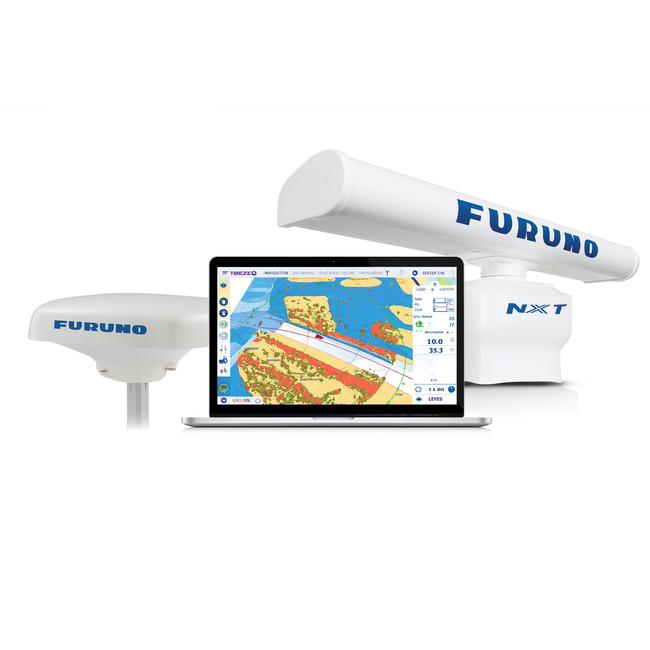
This advanced navigation system combines a reliable FURUNO Doppler radar (DRS6A-NXT) with an integrated PC radar module and the user-friendly TIMEZERO navigation software. The system is specifically designed for inland vessels and workboats that want a cost-effective secondary navigation system. Thanks to the intuitive interface, you can easily set waypoints, plan complete routes, and view real-time information on currents and weather forecasts. The revolutionary Target Analyzer in the DRS6A-NXT radar provides instant identification of approaching targets; when approaching a selected destination, speed and course vectors are immediately displayed. This makes the system ideal for anyone who needs to react quickly and accurately to changing maritime conditions. The radar requires no warm-up time and is equipped with ARPA functionality, allowing it to track up to 100 targets simultaneously. The added feature of the RezBoost™ gives you an extra-sharp radar image – even small objects like kayaks are clearly visible. The system also features an adjustable range (from 0.0625 to 96 nm) and a minimum resolution of 6 meters with 1-degree accuracy.
Revolutionary Target Analyzer ™ This feature instantly identifies dangerous targets by changing color. When you have selected a destination, a speed and course vector is displayed in seconds. Accurate tracking information makes it much easier for you to estimate the course and speed of other ships. Each vessel approaching your boat automatically displays a target vector and sounds an alarm.
With the FURUNO River Radar PC Navigation you have the possibility to plan routes and view currents and weather forecasts in addition to waypoints. Display your radar image directly in the TIMEZERO software and more options depending on your connections. You need TIMEZERO Navigation software with PC Radar Module to work on your own computer. you can choose your Card here
There is a Worldwide map coverage: mm3d map catalog with raster and vector maps (C-MAP and Datacore from Navioniqs). Worldwide tidal database to know water depth in ports as well as standard satellite photos.
TIMEZERO is the powerful navigational to of added confidence and safety capable of Blanding and analyzing dat from multiple sources in real-time. Features as multi-screen support and full network compatibility make it without a doubt the most accurate and advanced onboard tool of his kind. The use is very simple and provides comfort and thus increased productivity as well as extra confidence and safety
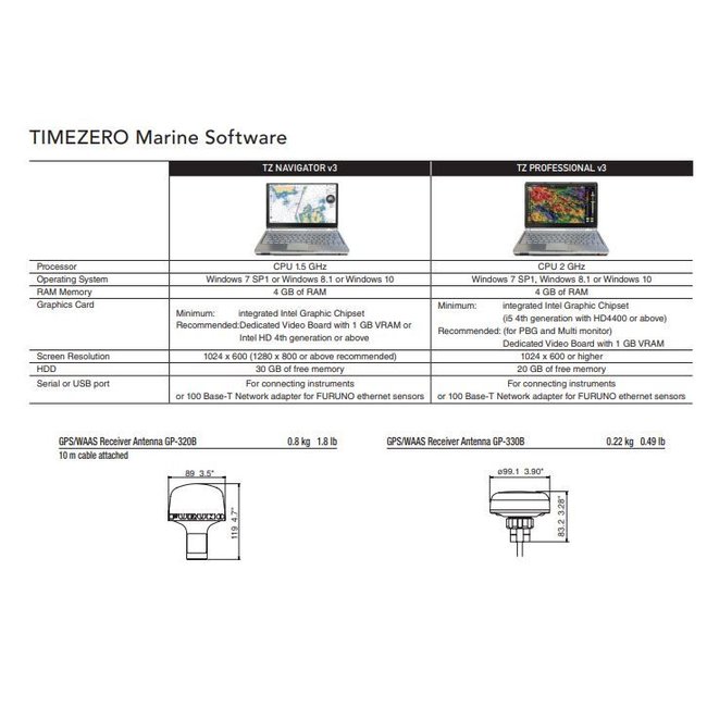
A standard PC with Windows 8.1 or Windows 10 works well to use the FURUNO RIVERRADAR possibilities with TIMEZERO Electronic Chart.
In addition, you need a SCX-20 Satellite Compass with four separate GNSS antennas for fast and accurate heading. The new FURUNO SCX-20 Satellite Compass provides highly reliable-and-accurate heading for your navigation network. a whopping 1.0 degree heading and 0.02 degree speed accuracy. See here the information of the SCX-20 compass
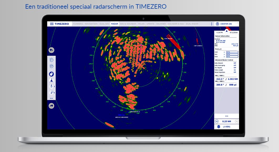
This is what a Traditional Radar screen looks like on your computer
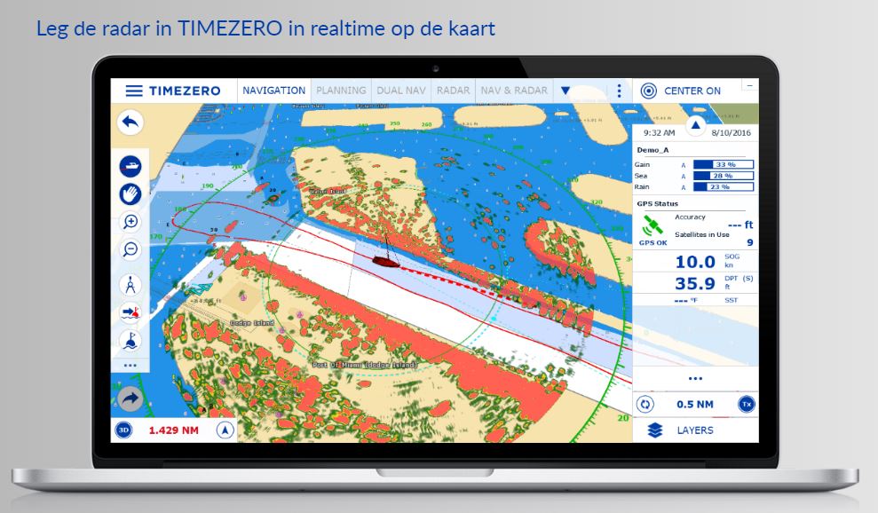
This is the situation with Radar overlay this is an effective safety tool that allows you to understand your surroundings of other ships and objects in relation to your current position.
If you have any questions about the FURUNO RIVER RADAR PC Radar NAVIGATION with PC Radar Module software and map from TIMEZERO, call us: 0031 252 544772, we will be happy to answer your questions.