C-Map 4 D Maps WIDE and LOCAL for FURUNO GP1971F and GP-1871F chartplotter.
Creating routes and waypoints is very easy. When connected to an AIS receiver, valuable AIS data is shown on the display.
Read more.
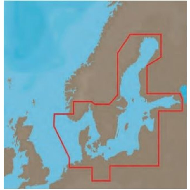
C-MAP charts provide unparalleled navigation details for the FURUNO chartplotter models and computer systems. Our optimized choice of chart types MAX-N, MAX-N + and Full 4D contain current data from official sources with extensive views such as depth ranges, coastal contours, shallow places, wrecks, anchorages, harbors and so on. Additional features and information about tides and currents plus Easy Routing to calculate the safest and shortest route and view potential hazards associated with a route. Type Full 4D offers all these mentioned functions plus additional functions such as raster maps, satellite recordings in 2D + 3D and additional 3D views. See below for examples of the readout. Powerful data that you can use to superimpose the vector maps, e.g. on relief vectors, tidal currents and sea plans, which significantly increases situational awareness. Creating routes and waypoints is very easy. When connected to an AIS receiver, valuable AIS data is shown on the display. Another standard feature
is C-Weather, which provides downloadable information about wind, waves, weather and humidity
Temperature that you can add to your schedule.
See here the GP-1971F Chartplotter