Menu
EUR

TZ MAPS

TZ Maps are charts that provide highly detailed navigation data for coastal and offshore waters with real-time updates.

21 Products
Show:
TIMEZERO  TZ MAPS: Europe - Western Mediterranean
TIMEZERO
TZ MAPS of the Western Mediterranean area with Raster, Vector, detailed land information, high-resolution satellite photos and high resolution Bathym... More
TZ MAPS of the Western Mediterranean area with Raster, Vector, detail...
€302,00 €249,59 €295,00 €243,80
You save 2%
 
 
TIMEZERO  TZ MAPS: Europe - Eastern Mediterranean
TIMEZERO
TZ MAPS of the Eastern Mediterranean area with Raster, Vector, detailed land information, high-resolution satellite photos and high resolution Bathym... More
TZ MAPS of the Eastern Mediterranean area with Raster, Vector, detail...
€302,00 €249,59 €297,00 €245,45
You save 2%
 
 
TIMEZERO  TZ MAPS: Europe - Iceland & Greenland
TIMEZERO
TZ MAPS of the Iceland & Greenland area with Vector, detailed land information, high-resolution satellite photos and high resolution Bathymetry. More
TZ MAPS of the Iceland & Greenland area with Vector, detailed land in...
€302,00 €249,59 €297,00 €245,45
You save 2%
 
 
TIMEZERO  TZ MAPS: North Europe - Norway
TIMEZERO
TZ MAPS of the waters surrounding Norway in Europe with Vector, detailed land information, high-resolution satellite photos and high resolution Bathym... More
TZ MAPS of the waters surrounding Norway in Europe with Vector, detail...
€302,00 €249,59 €297,00 €245,45
You save 2%
 
 
TIMEZERO  TZ MAPS: Europe - Baltic Sea
TIMEZERO
TZ MAPS of the Baltic Sea area with Raster, Vector, detailed land information, high-resolution satellite photos and high resolution Bathymetry. More
TZ MAPS of the Baltic Sea area with Raster, Vector, detailed land info...
€302,00 €249,59 €297,00 €245,45
You save 2%
 
 
TIMEZERO  TZ MAPS: Europe - Skagerrak & Kattegat
TIMEZERO
TZ MAPS of the Skagerrak & Kattegat with Raster, Vector, detailed land information, high-resolution satellite photos and high resolution Bathymetry. More
TZ MAPS of the Skagerrak & Kattegat with Raster, Vector, detailed land...
€297,00 €245,45
 
 
TIMEZERO  TZ MAPS: Europe - UK Ireland & the Channel
TIMEZERO
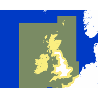
TZ MAPS of the UK Ireland & the Channel area with Raster, Vector, detailed land information, high-resolution satellite photos and high resolution Bat... More
TZ MAPS of the UK Ireland & the Channel area with Raster, Vector, det...
€297,00 €245,45
 
 
TIMEZERO  TZ MAPS: Europe - Western Europe
TIMEZERO
TZ MAPS of the Western Europe area with Raster, Vector, detailed land information, high-resolution satellite photos and high resolution Bathymetry. More
TZ MAPS of the Western Europe area with Raster, Vector, detailed land...
€297,00 €245,45
 
 
TIMEZERO  TZ MAPS: Europe -  North-Western Europe
TIMEZERO
TZ MAPS of the North-Western Europe area with Raster, Vector, detailed land information, high-resolution satellite photos and high resolution Bathyme... More
TZ MAPS of the North-Western Europe area with Raster, Vector, detaile...
€297,00 €245,45
 
 
TIMEZERO  TZ MAPS: North America - USA
TIMEZERO
TZ MAPS of the USA area in North America with Raster, Vector, detailed land information, high-resolution satellite photos and high resolution Bathymet... More
TZ MAPS of the USA area in North America with Raster, Vector, detailed...
€302,00 €249,59 €297,00 €245,45
You save 2%
 
 
TIMEZERO  TZ MAPS: North America - Canada East and North
TIMEZERO
TZ MAPS of the Canada East and North area with Raster, Vector, detailed land information, high-resolution satellite photos and high resolution Bathyme... More
TZ MAPS of the Canada East and North area with Raster, Vector, detaile...
€302,00 €249,59 €297,00 €245,45
You save 2%
 
 
TIMEZERO  TZ MAPS: North America - Central America & Caribbean
TIMEZERO
TZ MAPS of the Central America & Caribbean area with Raster, Vector, detailed land information, high-resolution satellite photos and high resolution B... More
TZ MAPS of the Central America & Caribbean area with Raster, Vector, d...
€302,00 €249,59 €297,00 €245,45
You save 2%
 
 
Showing 1 - 12 of 21
TZ MAPS

With TZ Maps, you gain access to precise, detailed navigation charts compatible with TimeZero Navigator, TimeZero Professional, TZ iBoat app and Furuno NAVnet TZtouchXL systems. These charts provide comprehensive information on depths, channels, hazards, and routes, making them perfect for both recreational and professional navigation. TZ Maps are optimized for 3D display and support radar overlay, ensuring that you always have access to the most up-to-date information for safe and reliable navigation.

Brands
Location
Price
Min Max
Close
Choose your language
Choose your currency

Recently added

Total incl. tax
€0,00
Order for another €500,00 and receive free shipping
0
Compare
Start comparison

This product has been added to your cart
Please accept cookies to help us improve this website Is this OK? Yes No More on cookies »